

Benefits
How to Use Satellite Data for Farmland Health Monitoring
Short Overview
Farming today isn’t just about the weather and the soil; it’s also about data. Farmers can now keep an eye on the health of their crops, find problems early, and get better yields thanks to satellite technology. This guide will teach you in simple, easy-to-understand language how satellite data works, how to use it to keep an eye on your farmland, and how it can make farming smarter, more profitable, and more environmentally friendly.

This full guide for beginners will show you how to use satellite data to keep an eye on the health of your farmland. Learn how NDVI, satellite images, and precision farming tools can help farmers find crop stress, boost yields, and cut costs. This guide breaks down everything into simple terms, from how satellite data works to the tools you need and the benefits in the real world. This article will help you make better farming decisions with modern technology, whether you are a small farmer or manage a lot of land for farming. With advanced satellite data solutions made for farming, you can increase productivity, keep an eye on the health of your crops, and use environmentally friendly farming methods.
Table of Contents
An Introduction to Using Satellite Data in Farming
Why it matters to keep an eye on farmland health
What is satellite data and how does it work?
Different kinds of satellite data used in farming
Important Signs of Healthy Crops
A Step-by-Step Guide for Farmers on How to Use Satellite Data Tools and Platforms
Advantages of Monitoring from Space
Problems and Limitations
Use Cases in Real Life
The Future of Satellite Farming Technology: A Summary
Getting to know satellite data in farming
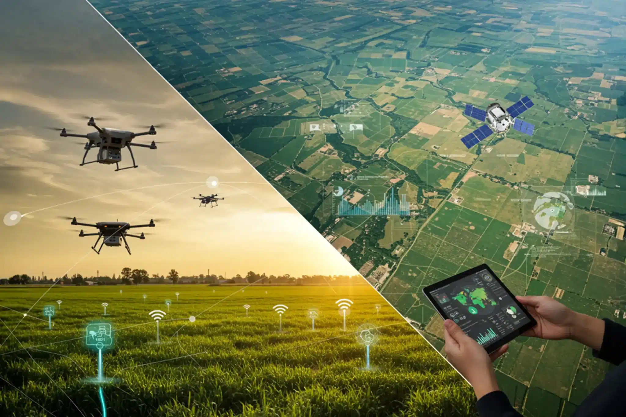
Farming has changed a lot since the old days. Farmers can now see their fields from space. Yes, from space, in fact. Farmers can see their crops in real time without having to walk through acres of land thanks to satellite data.
Farmers no longer have to guess if their crops are healthy or stressed. Instead, they use data-driven insights. This method lowers risks, saves time, and boosts output. Satellite monitoring can give you an edge over your competitors, whether you are a small farmer or in charge of a lot of agricultural land.
Why it’s important to keep an eye on the health of farmland
Better crops mean more food, more money, and farming that lasts. But it’s always been hard to find problems with crops early on.
A lot of problems like:
Stress from water
Lack of nutrients
You can’t see pest attacks until it’s too late.
Satellite data fixes this problem by finding small changes in crop health before they become serious. Farmers can act quickly and stop losses because they find out about problems early.
What is satellite data and how does it work?
Satellite data is the pictures and information that satellites take while they are circling the Earth. These satellites have sensors that gather information about the land, plants, water, and temperature.
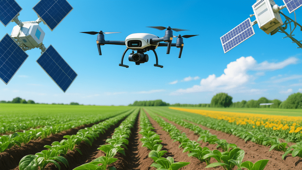
When satellites scan farmland, they pick up light waves that are not visible to the human eye. Then, this information is turned into maps and pictures that show how the crops are doing.
In short, satellite data is like a “health report” for your plants.
Different kinds of satellite data used in farming
To keep an eye on farmland, different kinds of satellite data are used.
1. Pictures taken with light
This is like a regular photo, but better so you can see the crop conditions clearly.
2. Data from infrared
Infrared helps find out how healthy a plant is by looking at how it reflects light.
3. Data on temperature
This shows how different the temperatures are in different fields, which can help find water stress.
4. Data from Radar
Radar can check the structure and moisture of soil even when it’s cloudy.
When you look at all the different types of data together, you get a full picture of how healthy the farmland is.
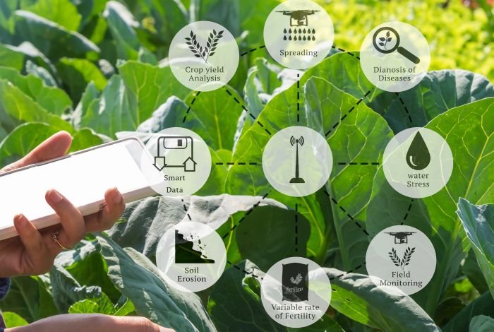
Important Signs of Crop Health
Satellite data helps keep an eye on important signs that show how crops are doing.
NDVI (Normalized Difference Vegetation Index)
This is one of the most important numbers that farmers use.
NDVI=(NIR−Red)(NIR+Red)NDVI=(NIR+Red)(NIR−Red)NDVI=(NIR+Red)(NIR−Red)NDVI=(NIR+Red)(NIR−Red)NDVI=(NIR+Red)(NIR−Red) Higher values mean that the crops are healthy, while lower values mean that they are stressed or damaged.
Some other signs are:
Crops that are healthy reflect more near-infrared light, while crops that are not healthy absorb more red light. This difference makes it easy for farmers to find problem areas right away.
A Guide to Using Satellite Data in Steps
It may seem hard to use satellite data, but it’s really not that hard when you break it down.
The first step is to pick a satellite data platform that you can trust. There are a lot of online tools that make maps easy to read.
After that, choose or upload the location of your farmland. The system will make pictures and give you information about your crops.
After that, look at the data. Look for differences in color or patterns on the field maps. These differences show where work needs to be done.
Once you’ve found the problem areas, do something about them. For instance, use fertilizers, change the way you water, or look for bugs.
Lastly, keep an eye on changes on a regular basis. You can see how things have changed over time with satellite data.
Farmers’ Tools and Platforms
There are a number of easy-to-use platforms that make it simple for farmers to get satellite data. These tools turn complicated data into easy-to-understand pictures.
Popular platforms offer:
Maps of crop health
Weather information
Data on soil moisture
Most of them are made for beginners and don’t need any technical knowledge.
Advantages of Monitoring from Space
There are many benefits to using satellite data in modern farming.
Farmers don’t have to check every part of their land by hand, which saves them time. It makes things work better by showing exactly where attention is needed.
It also lowers costs. Farmers can focus on the parts of the field that need it instead of putting fertilizers or water all over the whole thing.
Another big benefit is that it increases yield. Crops that are healthy grow better, which means more production and profit.
Satellite monitoring also helps sustainable farming by cutting down on waste and saving resources.
Problems and Restrictions
Satellite technology is very useful, but it’s not perfect.
Cloud cover can sometimes block optical images, which means that data isn’t available. Radar satellites can help with this problem, though.
Another problem is resolution. Some satellites might not be able to get very detailed pictures of small farms.
Farmers also need to know the basics in order to understand data correctly. But this is getting easier every day thanks to new tools.
Real-Life Examples
Farmers all over the world are already using satellite data to make their farms better.
Many farmers in India use satellite data to keep an eye on how stressed their crops are and to make the best use of their irrigation systems. This helps them use less water and get more crops.
Satellite monitoring helps big farming companies keep track of thousands of acres more easily.
Even government agencies use satellite data to figure out how much food is being grown and make plans for farming policies.
The Future of Technology for Satellite Farming
Technology has a big impact on the future of farming.
Farmers will get alerts in real time about problems with their crops’ health. Automated systems will quickly suggest fixes.
Drones and satellites will work together to give farmers more information, making farming smarter and more efficient.
Conclusion
Satellite data is changing how we think about farming. It gives farmers a whole new way to look at their fields and make better choices based on real information.
Farmers can find problems early, save money, and get more done by using satellite data to keep an eye on the health of their land. The technology is getting easier to get, which makes it easier for farmers of all levels to use.
In the next few years, farming with satellites won’t just be an option; it will be necessary for farming that is both profitable and good for the environment.


NEET UG Re-Exam 2026: Why Telegram Was Restricted in India and What It Means for Students

Spotify Outage 2026: Thousands of Users Report Streaming Issues Across the Globe

Stock Market Today: Sensex, Nifty & Top Stocks in Focus Amid Global Market Uncertainty

NEET Re-Exam Admit Card 2026 Released: Direct Download Link, Exam Day Guidelines & Important Updates

Made-in-India C295 Aircraft Maiden Flight Marks a New Chapter in India’s Defence Manufacturing

Higher Ethanol Blended Petrol Gets Excise Duty Exemption: What It Means for India’s Fuel Future

What I Eat In A Day As An Indian Diabetic To Lose Weight

10 Simple Indian Home Habits That Help You Lose Weight With Type 2 Diabetes

Diabetes-Friendly Indian Breakfasts That Melt Belly Fat and Control Blood Sugar Naturally
